Rocas Project
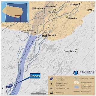
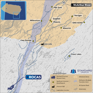
The Rocas project comprises three mineral dispositions totalling 4,002 hectares, located 75 kilometers southwest of the Key Lake Mine and Mill facilities along Highway 914, and approximately 72 kilometers south of the present-day margin of the Athabasca Basin. The project was acquired via staking in May 2023, and Standard Uranium holds a 100%-interest in the property.
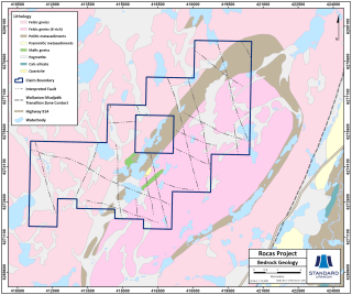
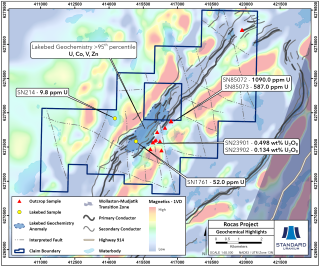
The Project covers 7.5 kilometres of a northeast trending magnetic low/electromagnetic (EM) conductor corridor which hosts several uranium anomalies, including historical mineralized outcrop grab samples along approximately 900 metres of strike length, grading up to 0.50 wt.% U3O8. Notably, none of the historical uranium occurrences have been drill-tested.
Historical airborne EM work in 2017 defined conductive trends on the Project west of and sub-parallel to the Key Lake Road shear zone, corresponding with favourable metasedimentary basement lithologies. Multiple parallel conductors, offsets, and termination points indicate the trend widening and potential cross-cutting structures. Additionally, a 2007 field sampling program identified anomalous lakebed geochemical anomalies that statistically rank as greater than 95th percentile U, Co, V, and Zn along the conductor corridor, including high U/Th ratios.
In 2024, MWH Geo-Surveys (Canada) Ltd. was contracted to complete a high-resolution ground gravity survey along known conductive exploration trends on the Rocas project. The survey was designed to aid in the identification of potential zones of hydrothermal alteration of host rocks associated with uranium mineralization events.
The gravity surveys across the conductive structural corridors improve definition of drill targets for future exploration programs. Convolutions Geoscience have completed detailed inversion and 3D modeling, which will provide additional vectoring layers for future drill programs. Value-added products include 3D density inversions, depth slices, modeling interpretation, and expert recommendations.
Four new drill target areas have been identified on the Rocas project, outlined via the confluence of low gravity anomalies, historical surface mineralization, lakebed geochemical anomalies, EM conductors, and crosscutting fault zones.
The integration of historical results with these newly developed target areas has generated prospective drill targets, which the Company plans to drill test in 2026.
Disclosure of Technical and Scientific Information
Except as otherwise noted herein, Sean Hillacre, MSc. P.Geo., Standard Uranium’s VP Exploration, has reviewed and approved the scientific and technical information contained in this website. Mr. Hillacre is a Qualified Person within the meaning of Canadian Securities Administrator’s National Instrument 43-101.


